Understanding Drones: Types, Features, and Safe Operation
Outline and How to Use This Guide
Drones have moved from niche hobby to everyday tool, blending flight, imaging, and data collection into compact airframes you can carry in a backpack. Whether you are filming a coastal sunrise, checking a rooftop after a storm, or stitching a map of a farm, the right platform and smart safety habits turn curiosity into reliable results. This guide starts with a clear roadmap, then dives deep into aircraft types, critical features, and responsible operation. Use it as a reference when comparing models, building skills, and planning your next mission.
What to expect as you read:
– Overview: A structured outline to frame your learning and help you scan for what matters most to your goals.
– Types: A practical comparison of multi-rotor, fixed-wing, single-rotor, and hybrid aircraft, including flight time ranges, lift characteristics, and use cases.
– Features: A plain-language tour of controllers, positioning systems, batteries, cameras, radios, and failsafes, with tips on reading spec sheets.
– Safety: Core rules seen in many countries, preflight planning, weather awareness, privacy, and wildlife considerations.
– Choices: A buying and maintenance checklist grounded in real tasks like photography, mapping, inspection, and fieldwork.
How to apply the material:
– Start with your mission. Define what success looks like: the image resolution you need, the area you must cover, or the payload you must carry.
– Pick an airframe aligned to that mission. Endurance and wind tolerance matter for mapping in open country; precision hover and gimbal stability matter for cinematic shots.
– Validate safety and compliance before launch. Confirm local altitude limits, no-fly zones, and visibility requirements, and build a simple preflight routine you can repeat every time.
– Improve iteratively. Log each flight, note battery performance and wind conditions, and adjust propellers, filters, or flight plans based on results.
As you move through the sections, you will see a recurring pattern: define the job, choose the airframe, equip with the right sensors, plan the route, fly within safe limits, and review data. That rhythm keeps operations predictable and stress low. By the end, you will not only know what to buy or upgrade, but also how to protect people, property, and your aircraft while getting consistent, usable output.
Drone Types and Airframes: Strengths, Trade-offs, and Ideal Uses
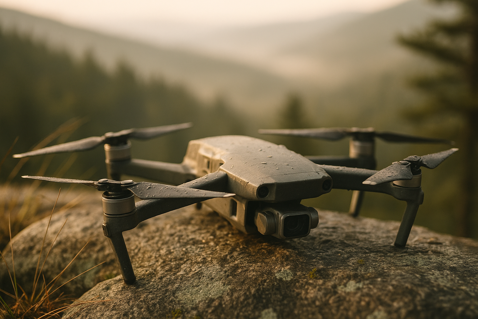
Airframe choice determines what your drone can realistically achieve. Multi-rotor craft—most commonly quads—dominate because they hover precisely, lift vertically, and fit in small cases. Typical consumer quads deliver 20–35 minutes of flight per battery in light winds, carry 100–800 grams depending on motor class, and handle confined spaces well. Hexa and octo variants add redundancy and lift for heavier payloads, trading portability and cost for stability in wind and smoother footage under load.
Fixed-wing drones fly like small airplanes, converting electrical energy into efficient forward motion through lift. Because wings carry the aircraft, fixed-wings can cover large areas quickly, often achieving 60–120 minutes of endurance with modest batteries. They shine in mapping and long-range monitoring, yet they need more open space for launch and recovery and cannot hover for detailed shots. Single-rotor helicopters offer strong lift and longer flight times than similar-weight quads, but they introduce mechanical complexity, higher rotor inertia, and a steeper learning curve.
Hybrid VTOL designs blend fixed-wing efficiency with vertical takeoff, using tilt-rotors or dedicated lift motors to rise and transition to forward flight. They can map like a wing but launch from small sites, which suits surveying and environmental monitoring where landing areas are limited. Micro and nano craft under roughly 250 grams add travel-friendly convenience and reduce kinetic energy, making them approachable for training and low-risk imaging, especially where lighter categories face fewer regulatory hurdles. FPV racers prioritize speed and agility—often exceeding 100 km/h—accepting short flight times and minimal automation for immersive piloting and fast response.
Consider this quick alignment guide:
– Cinematic video in tight locations: multi-rotor with a stabilized gimbal and predictable hover.
– Large-area mapping with overlapping photos: fixed-wing or VTOL hybrid for endurance and coverage speed.
– Heavy sensor payloads or lifting tools: hexa or octo platforms for thrust overhead and motor redundancy.
– Skill building and casual travel: sub-250 g multi-rotor for simplicity and reduced risk.
– Racing and freestyle: FPV builds emphasizing power-to-weight and durable frames.
Wind resistance also varies. Multi-rotors with larger propellers and higher thrust margins handle gusts better, but they burn more energy. Fixed-wings ride turbulence differently; while bumps appear in imagery during gusts, the aircraft remains energy-efficient in cruise. Noise profiles differ too: larger slow-spinning props typically sound lower in pitch and carry less distance compared to small high-RPM setups. Matching the airframe to your task, environment, and learning stage is the surest path to consistent outcomes and lower total cost of ownership.
Features and Technologies: What Specs Mean in Real Flights
A drone’s performance comes from the interplay of sensors, power, aerodynamics, and communication links. At the center is the flight controller, fusing data from the inertial measurement unit (gyroscopes and accelerometers), barometer, magnetometer, and satellite receivers. Modern GNSS modules track multiple constellations—commonly GPS, Galileo, and others—to improve lock speed and reduce positional drift. For mapping and inspection, real-time kinematic (RTK) or post-processed kinematic workflows can tighten positioning to centimeter-level accuracy when supported by ground references.
Obstacle sensing relies on stereo vision, time-of-flight, or radar modules. These aid collision avoidance and subject tracking, though they are not a substitute for pilot awareness. Return-to-home logic triggers on low battery, signal loss, or manual command; learn how your aircraft climbs, cruises, and descends during this sequence to avoid obstacles on the route. Radio links often operate in 2.4 or 5.8 GHz bands; lower frequencies bend around obstacles a bit better, while higher frequencies may offer cleaner channels in crowded urban noise. Range varies widely with antenna design, line-of-sight, and regulations—always fly where you maintain reliable control and video downlink.
Power systems shape flight time. Lithium-polymer packs deliver high discharge rates and punchy performance; lithium-ion packs trade current for higher energy density, sometimes extending endurance in gentle cruise. Energy densities commonly range around 140–250 Wh/kg depending on chemistry and build. C-rating expresses safe discharge rate; a 4,000 mAh pack at 10C supports up to 40 A draw. Propeller diameter and pitch govern thrust and efficiency: larger, slower props can reduce noise and improve endurance, while aggressive pitch increases speed but demands more current.
Imaging payloads span tiny sensors near 1/2.3 inch up to larger one-inch or micro-format sensors. Bigger sensors generally provide improved dynamic range, cleaner low light, and better color depth. Gimbals stabilize footage on two or three axes, suppressing vibrations from motors and wind; balanced props and well-isolated mounts further tame jello. Video codecs like H.264 and H.265 compress footage efficiently; higher bitrates preserve fine detail, especially in foliage or water scenes. For mapping, look for controlled overlap, consistent exposure, and precise geotags rather than cinematic frills.
Weather sealing and wind ratings matter more than spec sheets sometimes admit. Manufacturers may quote steady-wind resistance around 8–12 m/s for compact craft; payload and frontal area will shift real-world results. Cold weather reduces battery output and increases voltage sag; warm weather accelerates chemical aging. Practical spec priorities:
– Mission-critical: reliable GNSS, solid radio link, predictable RTH behavior, and sufficient thrust margin.
– Imaging focus: sensor size, gimbal stability, lens sharpness, and bitrates that fit your editing workflow.
– Mapping and survey: RTK capability, interval shooting, and consistent ground sampling distance at planned altitude.
– Field durability: quick-folding arms, accessible battery latches, and spares like props and landing skids.
Understanding what each spec actually does in the air helps you avoid paying for features you won’t use, while investing in capabilities that transform your results.
Safe Operation, Airspace, and Ethics: Flying Responsibly
Safety begins long before motors spin. Many jurisdictions draw a regulatory line around 250 g for registration or additional requirements, and cap routine flights below approximately 120 m (400 ft) above ground level to keep clear of crewed aircraft. Maintain visual line of sight, yield to all manned aviation, and avoid flying over crowds or moving traffic. Expect extra rules near airports, seaports, prisons, power stations, and nature reserves; geofencing can assist but is not a guarantee, so verify airspace with official charts or government-provided tools.
Build a repeatable preflight routine. Inspect the airframe for cracks, loose screws, and worn prop tips; check battery voltage and cell balance; verify firmware currency; confirm compass and IMU health; and format or swap memory cards. Review your mission plan, noting takeoff and landing spots, emergency hover points, and a conservative return-to-home altitude. Weather awareness pays dividends: gusts above the aircraft’s comfort range shorten flight times, strong sun heats electronics on the ground, and cold air saps battery performance. Avoid rain unless your platform is explicitly rated for it.
Consider this simple checklist you can print and keep:
– Site survey: people, vehicles, obstacles, antennas, trees, and power lines.
– Airspace: altitude limits, temporary restrictions, heli routes, and local advisories.
– Equipment: props tightened, antennas oriented, batteries above mission threshold, spares packed.
– Flight plan: route, altitudes, photo intervals or waypoints, contingency landing sites.
– Postflight: motor temperature check, prop condition, battery logs, and card backups.
Privacy and ethics matter as much as aerodynamics. Even if local law permits a flight, respect property boundaries and avoid lingering near windows or private yards. Wildlife is particularly sensitive to noise and silhouette; keep wide buffers, especially during nesting and breeding seasons, and abort if animals show signs of distress. If flying for work, you may need certification, insurance, or permissions—requirements vary, so consult official sources and when in doubt, seek written clearance.
Finally, know your limits. Practicing in open fields, using simulators to rehearse emergency procedures, and logging weather versus performance will expand your decision-making under pressure. Responsible operation protects your community and preserves the freedom to fly, while also safeguarding your investment and the data you’ve worked to capture.
Use Cases, Buying Decisions, and Maintenance for Long-Term Success
Drones excel when matched carefully to a problem. Visual creatives lean on stabilized hover, clean color science, and neutral-density filters to maintain shutter angles in bright light. Real estate and tourism imagery benefits from smooth lateral moves at low altitude and precise framing. Surveyors prize predictable overlap, consistent ground sampling distance, and accurate geotags for photogrammetry. Farmers and researchers may equip multispectral cameras to estimate plant vigor, inspect irrigation issues, or map storm damage. Inspectors rely on long flight times, wind tolerance, and oblique imaging to catch cracked tiles, loose fasteners, or hotspots on solar arrays.
Choosing a platform becomes easier if you convert needs into specs:
– Endurance and coverage: target minutes per battery and area per flight; for mapping, compute how altitude, speed, and side overlap affect mission count.
– Payload and lift: define grams of camera plus gimbal; leave 20–30% thrust overhead for gusts and aggressive braking.
– Imaging requirements: sensor size, lens field of view, minimum shutter speed, and codec/bitrate compatible with your editing pipeline.
– Link reliability: confirm expected range in open air, interference resilience in cities, and available antenna options.
– Portability and setup: weight, foldability, and time from case to air matter on fast-moving jobs.
Budget beyond the aircraft. Batteries are consumables: many packs deliver roughly 150–300 cycles when treated gently—stored around 40–60% charge, kept cool, and never pushed below conservative voltage limits. Spare propellers, a parallel or dual charger, a field toolkit, and a landing pad reduce downtime. Consider liability coverage if flying near people or property. Keep firmware, obstacle databases, and controller apps updated, but test major updates in a safe area before commercial flights.
Maintenance is straightforward if consistent. Replace props after strikes or when edges lose their crisp profile. Inspect motor bells for dust and minor dents; listen for bearing noise on spin-up. Clean gimbal dampers and camera glass, and check landing gear for cracks after rough terrain use. Keep detailed logs: battery internal resistance, cycle counts, charge temps, and any anomalies like sudden voltage dips. Store gear in a dry case with silica packets, and avoid leaving batteries in hot vehicles.
Skill growth compounds everything. Start with open-field sessions to master orientation, braking, circle and figure-eight patterns, and gentle descent without prop wash. Gradually add complexity: waypoint missions, orbit shots, and emergency RTH rehearsals. For mapping, practice consistent overlap and flight lines, then validate results by measuring ground sample distance and checking for stitching artifacts. By turning intentions into measurable checklists, you transform curiosity into dependable outcomes that clients and collaborators can trust.
Conclusion: A Confident Path from Curiosity to Competence
If you are exploring drones for creative work, field research, inspection, or simply the joy of flight, the path forward is methodical and rewarding. Choose an airframe aligned to your mission, invest in features that truly affect your output, and commit to a repeatable safety routine. Keep learning from each flight log, and let results—not hype—guide upgrades. With thoughtful planning and steady practice, your aircraft becomes a reliable partner that opens the sky without closing your options on the ground.